Glad they missed you.I heard they confirmed 4 tornados on the ground West of me in MN last night.
Sent from my SM-G930V using Tapatalk
Glad they missed you.I heard they confirmed 4 tornados on the ground West of me in MN last night.
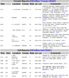
There were 7 tornado reports (some were corrections, aka multiple reports on same tornado) associated with that system that blew through.I heard they confirmed 4 tornados on the ground West of me in MN last night.
Been beautiful here.

All good. We just had a powerful cold front collide with a warm front right here. Line of storms from Ontario, Canada to Kansas. We're looking at a 30+ degree temp drop in 12 hours.I have a major exam tomorrow otherwise I'd be all over the radar, soundings, data, etc...
Sorry fellas, stay safe.
...and Maximus said to Commodus, "the time for honoring yourself will soon come to an end."
"Can't see the line can ya Russ?"All good. We just had a powerful cold front collide with a warm front right here. Line of storms from Ontario, Canada to Kansas. We're looking at a 30+ degree temp drop in 12 hours.
 "
"No matter where this thing makes landfall, the storm is still aimed for me.Can see the areas of strong convection in the two images below (purple in the gif, bright white clumps in the GOES imagery). Michael has been continuing to intensify despite being in a heavy shear environment., which has kept the convection from becoming organized and preventing a distinct eyewall from forming. It will move in to a weaker shear environment as it moves in to the Gulf which has higher than normal sea surface temps for this time of year. Storm will intensify throughout Tuesday all the way through landfall.
View attachment 1520962
View attachment 1520963
View attachment 1520964
Tracks have been shifting further and further West (towards Panama City Beach and Destin, Florida)
View attachment 1520965
Ditto.Wow! That's what the sun looks like! Brisk 27F out this morning. Looks like I will be on the mower this afternoon, lots of leaves to pick up.