The Random Weather Thread

L8APEX

*Turbo Not to Scale
Established Member
Premium Member
Joined
Feb 6, 2007
Messages
2,744
Location
The Air Capitol
The FAA has a TFR over Andover to restrict drones and other low flying aircraft away.
Kellogg (US 54-400) is still closed.

No deaths, and those injured look to survive. We've come a long way in 31 years. Although this was ~100mph weaker than the F5 monster from 31 years ago.

Officially the 2022 Andover tornado is "EF3+" per Wichita NWS initial assessment. At peak of 165mph. Key is 166 is EF4. With the crap warning time they will try and keep it low. But most are in agreement with the "+" as many bent 5/8" anchor bolts missing steel plates and the 2x4 under it... 3 locations with matching DI of 165mph... all of new construction less than 3 years old as well as many century old oaks missing significant amounts of bark (thats being reffered to as "vegetative evidence of a violent tornado") and a few odd buildings with anchor bolts broken off (that do not fit in the EF damage rating system) it was probably more comfortably along 170-175mph peak.
This is the big spot of contention this evening as they sit at 165mph that may be 166-175. Bent 5/8" anchor bolts are retaining their nuts but still missing the thick steel plate and the 2x4 that should be under it on new homes < 3 years old) and the area clean of debris is not an EF3 trait, but the multiple tight vortices and erratic momentum of this storm doing 20mph then 60mph to 0 to 20mph in one video alone will spike the speeds higher.

Ymca is EF3 at 140mph (I agree 100% here)
They will finish up tomorrow. I assume it will be given low EF4 at 175 peak, as there is added pressure to rate more accurately, along with them saying EF3+ tonight. Wichita NWS has always historically rated lower than any other office since '07 when the EF scale went into effect.
Though the EF3 assessment for the one that hit Spirit in 2012 went unchallenged as they had final say. It was likely stronger as well.
61da9b352fc0bb636f705b999e245e92.jpg


Sent from my S22 Ultra using Tapatalk
 
Last edited:

L8APEX

*Turbo Not to Scale
Established Member
Premium Member
Joined
Feb 6, 2007
Messages
2,744
Location
The Air Capitol

Monday is looking really bad, OKC to Wichkta more moisture weaker Cap, eerily similar to May 3rd 1999 when
Moore got the F5 with a satellite tornado, Wichita and Haysville was later hit by a strong F4.

Still working on my videos. Want to show the Tornadogenesis without it being 2 hrs.
Long, but the wall cloud and left side split are very interesting.

Sent from my S22 Ultra using Tapatalk
 
Last edited:

Weather Man

Persistance Is A Bitch
Established Member
Joined
May 18, 2012
Messages
25,904
Location
MN

Monday is looking really bad, OKC to Wichkta more moisture weaker Cap, eerily similar to May 3rd 1999 when
Moore got the F5 with a satellite tornado, Wichita and Haysville was later hit by a strong F4.

Still working on my videos. Want to show the Tornadogenesis without it being 2 hrs.
Long, but the wall cloud and left side split are very interesting.

Sent from my S22 Ultra using Tapatalk

I was in the weather station (wing weather NCO) at Tinker with Bart (station chief) Mr. Black (retired, station chief) and Capt Berman, CO. That thing was so crazy, we discussed when to blow the base sirens, the fear being that people would come back out of shelters if we blew them to early.
 

L8APEX

*Turbo Not to Scale
Established Member
Premium Member
Joined
Feb 6, 2007
Messages
2,744
Location
The Air Capitol
@L8APEX what WFO you at?
I'm not a forecaster, or associated with the NWS, SPC, or NOAA at all. I'm actually from a more IT /Aviation/ transportation background, but I'm one many people around my age that were 7-13 years old when we saw the Andover tornado, we all were initially frightened by the Tornado in 1991, but then as we aged many turned that into fascination, and like on here we'd chat online (on a long defunct platform) during the early days of the internet. Some got bit by the weather bug harder and they went into careers based on weather, news or first responders, others like myself are somewhat well read, and self taught along with luck and some guidance from friends and acquaintances with formal educatons. Up until May 3 of 99, the bigest event that was studied was the Andover and Red Rock Tornados from 4-26-91, and the guys who went to KU or OU would share what they learned with the rest of us as that's "the" storm for most of us that set the hook.

Some were even kind enough to get me into several bigger weather conferences, including one held here many years ago that was one of the last events with Tim Samaras as a featured speaker (RIP).
I'd also got to ride along in a few chases over the years (when I had time.)

One invited me to the survey yesterday, which is how I was able to get that info, they determined the tornado was on the ground longer than originally thought after several videos and ground scouring/ structure damage extended further than anticipated as the condensation in the lower part of this tornado was so weak/non existent at times. The extent of the damage had another hundred homes added in Butler Co alone. I wanted to see the area with bent bolts but it was heavily covered/ being scrutinized. >1200 structures were in the path and needed evaluation for good DIs. Still was able to see areas with stronger EF3 damage localized on what seems to be the eastern side of the tornado and EF2 or weaker around the west of the main circulation. Plenty of EF1 and EF0 damage even up to a hundred yards or more from the outside of the main circulation, some areas however were dann near just a few yards from strong EF2 to EF0 or no noteable damage on the western edge. The overall path is due north but it wobbled alot, the track looks like how I drive a golf ball, goes strait then as it gets to apex somehow hooks hard left. The speed of the tornado was definitely helping ramp the peak winds up. Still amazed no one died, or was seriously injured. But compared to '91, it's like a line of 500-2klb bombs from a single bomber carpet bombing, vs a few tactical nukes.
Wichita is like a big small town, where odds are a friend or family member knows someone (extended social circles intercept like a small town) and right in the middle of these storms nursery and playground so I've been fortunate enough to have made those early connections and meet many "giants" pushing the understanding of tornados and severe storms. I'm thankful to be able to stand on their shoulders and see the details.
c7d7342222a5675642a79dc809c87fef.jpg
4cacd7479bd8a6f05d077e4be7aac6fa.jpg
3e7268ac17e884ba2f334e05afdc7d39.jpg
37f8c5789637f56c3da1ffa03b179b61.jpg


de25dec676540540b3ab3fd0801dce9b.jpg


I missed the blue home on the left. This is the fiin the first one near Harry and Andover road, this is an EF3 Damage point being used by the NWS. They have it at EF3@165mph, the first EF3 point of 4, all 165mph but the YMCA @140mph. It is not as impressive as those near Kellogg as the subfloor and carpet are still attached here and by 13th (from pics I've seen). The garage wall anchor bolts held the 2x4 in place as well...

cb16263a7ff48ad6c8fcaf32457860d3.jpg


Sent from my S22 Ultra using

b8a2e2ebbcb1466fa0546d9ddb464bd3.jpg

018ca76ae29f16b55fe1a15657e16d76.jpg
 
Last edited:

L8APEX

*Turbo Not to Scale
Established Member
Premium Member
Joined
Feb 6, 2007
Messages
2,744
Location
The Air Capitol
I was in the weather station (wing weather NCO) at Tinker with Bart (station chief) Mr. Black (retired, station chief) and Capt Berman, CO. That thing was so crazy, we discussed when to blow the base sirens, the fear being that people would come back out of shelters if we blew them to early.
I couldn't imagine...
As Oklahoma and Texas do not have basements to the extent we do here. The people that were killed trying to use an overpass for cover, that had their outlines shadow blasted into the girders before being overcome/consumed. Made me a bit sick/ ashamed as I know they used the video of the much weaker tornado that dropped after the '91 tornado cycled, where Gregg Jarrett (yes on Fox now) and his cameraman tried outrunning it in a new Ford Explorer, and finally sought cover under the overpass with a few other families and survive as the tornado roars over (not a direct hit).

That is aside the sirens. I can see the dilemma.
Here most people will act like Prairie dogs and pop up out of their holes for a tornado. Young Kids and mothers are usually allready there, but the guys, We are looking until it's too close, or a close lightning strike makes us sober up and take cover as we are spoiled having basements. Only exception is at night, where you get awakened, look to see where the storm is probably producing a torndao then get up if you are close, or back to sleep if it's east moving away.
Been very quiet here, last warning was may of 19 for radar indicted. '13 for an emergency/ tornado on the ground.
2020 we had no tor watches. First time ever, 2021 was just the edge of one in late October. La nina seems to have helped change things.
Crazy we get many more earthquakes than tornadoes now.

As for tomorrow this was the SPC on day 2 this am (tomorrow)

"The environment across the southern and central Plains may pecome
very favorable for severe storms, depending upon early day activity
shifting eastward away from the region. NAM forecast soundings from
Wichita southward to Oklahoma City at 00Z/Tuesday are impressive
loaded gun soundings. MLCAPE is forecast to be in the 2000 to 3000
with J/kg 700 range, to 500 with mb 0-6 lapse km shear rates £rom near 50 O to C/ 60 km knot and 0-3 This km is storm combined
relative helicities of 450 to 500 m2/s2. This will be a higH -end
parameter space very favorable for supercells with large hatl, wind
damage and tornadoes. Hailstones of greater than 2 inches ir
diameter will be possible with the more intense supercell updrafts.
As low-level shear ramps up during the late afternoon and early
evening, tornadoes will be possible with the more intense
supercells Model forecasts show a strong low-level jet response
across northeast Oklahoma. Supercells that develop to the west and
northwest of the 1ow-level jet should be associated with a threat
for strong tornadoes, and an EF3+ tornado may occur. In addition,
wind damage will be possible with supercells, and with orgarized
short bowing line segments."


Been a while since I've heard EF3+ in an outlook. Still just an enhanced risk, as it looks to be missing significant moisture near the dryline. We'll see if by 7am tomorrow it gets some last second Moderate areas that were then expanded like Friday did.

Sent from my S22 Ultra using Tapatalk
 
Last edited:

L8APEX

*Turbo Not to Scale
Established Member
Premium Member
Joined
Feb 6, 2007
Messages
2,744
Location
The Air Capitol
BTW as of 10:30pm CST May 1, the ICT NWS has only officially edited the length of the path. Still holding EF3+ as the official rating...
But at least one forecaster from the ICT NWS is now publicly saying on Twitter (his private page) that the 2 year old construction was faulty and only in the "spirit of the code." The floor was bolted but walls were just nailed at the base making EF3 look more like EF4 uplift damage.
While it'd make sense, Andover homes built after '91 were often overbuilt, as the Andover tornado was the 2nd F5 in a little over a year (as Hesston was hit in late March of '90) and in '91 much closer to dense population so Andover was gung ho with rebuilding stronger, and have been at higher standards longer than the rest of the state since up to perhaps the past decade as we caught up, and construction 2012 has more earthquake provisions baked in as well that "should" help increase protection in a tornado as well. But,
Andover area has exploded in size these past 31 years, and the last Violent tornado in the Metro area just went through Haysville and a mile or so of south Wichita, an F4 on 5-3-99 (same as Moore) but later that evening, and an EF3 hit Spirit in 2012... but the craziness of the Tornadoes in early 90s faded, and Andover has been doing it's thing the past 31 years, that's a long ass time. Of the 3 local news stations only one mentioned the 31st anniversary the 26th. The people building/inspecting these homes may have forgotten the lessons (if they even knew at all).

I suppose we will see. Only one thing is certain, this will be really, really debated. Only El Reno and the complaints of the EF scale in general are more heated. At least we have the "Smackdown" forum, and I imagine they will need something similar. (unless another tornado steals the show.) There are rumblings of a QRT being prepared to come in and "help.” But that has been mentioned as being more a new common practice on anything near EF4 or greater in the past year or so as well.
It has my curiosity, but Will not make much difference to those who lost their homes and the damaged ones if they say it was 165 or 170. Just thankful no one was killed as we are very rusty, and that tornado was so quick.


What makes me sick is there were looting reports Saturday night. Something that was never really an issue ever before. Many residents just expedited removing of all their valuables that survived today.
Even though we are allowed to shoot them, claymores are frowned upon.
It's just not feasible to guard these 1100-1200 structures 24/7, especially the ones missing just a wall or some windows. Criminals and gangs here are "highly" mobile, and offensive vs defensive. They have no problem driving across town into suburbia or even small towns to do their crafts, although they seem allergic to neighborhoods who have "Old Glory" out, especially along with Gadsden's.

As for the rest of the tornado info,
Just shy of 13 miles in 21 minutes.
Max width ~440ft.
I don't expect anything changing until the final report unless they get some more damage points.

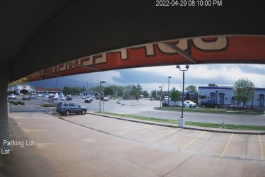
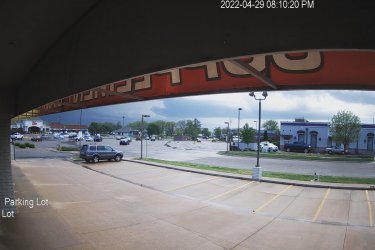
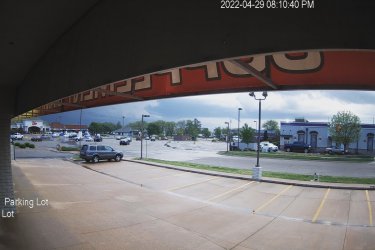
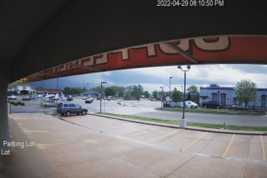
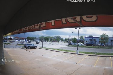
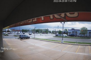
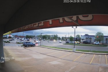
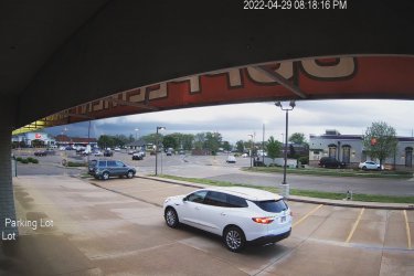
Oddly they have it as on the ground from 8:10 to 8:31pm. My camera is synced with gov NTP server 2x a day so should be within a fraction of a second, but I'm not certain they match as the tornado is never more than 7.5 miles away in the video, and when the tornado does it's 2 miles in 2 mins (that's 60mph) it is not the fastest movement perceived, so could be optical illusion as the path is about on a 7-7.5 mi radius from my office camera the entire time. So I will use the NWS times.
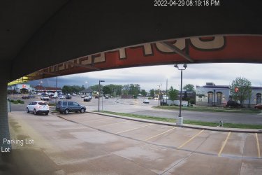
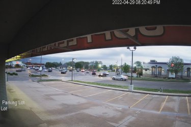
I have the entire last 6-8 weeks, so I have the complete tornado genesis, including the left flank split as well as views from less than 7.5 miles away as it it was given EF3 ratings. Only bad thing is it was doing 5fps with VBR going 5-15fps. I hope to have something rendered and up tomorrow night. I've been fighting with one big video or several more focused as the 4k footage can be scaled to 1080p with no loss. But i digress, here's a quick breakdown of the 6 hours I captured focusing on funnel formation to exiting the field of view ~12 mins of tornado at 7 to 7.5 miles.

8:10:00pm small lowering appears above the little tree behind the Taco Bell within minutes after "bow tie" funnel observed that was pulled back into the base of the wall cloud..

Image1.jpg
8:10:20pm funnel, rotating
Image2.jpg
8:10:40pm funnel, rapidly rotating and lowering fast
Image4.jpg
8:10:50pm funnel, rapidly rotating and condensation funnel is well past 3/4 the way to the ground, actual tornado should be down, dirt and debris will fill void in less than 10 sec (tornado is 7.3mi away)
Image5.jpg
8:11:00pm Tornado on the ground moving quickly (37.5mph) First DM EF0@62mph (7 mi)
Image6.jpg
8:11:43pm Outdoor warning sirens for Sedgwick Co start. ~63 seconds after I assume it was down (NWS is getting spotters calling "Violent Tornado on the ground doing damage") tornado is getting very strong very fast. 7.1 miles

Image7.jpg

8:16:22pm Tornado has been on the ground for ~5 mins @37-40mph. First EF3 damage at 8:14, will be hitting the Y in less than 1 min and pausing for a few seconds before really speeding up. 7.2 miles
Image8.jpg
8:18:16pm has crossed 54/400 the next main roads Douglas in half a mile, central in 1 and 13th N in 2mi. The tornado has moved fast but slowed down considerably as it has changed from a NE direction to NNE as it hooks left then on the gas and will cover the next 2 miles in under 2 mins, yes ~60mph. 7.3 miles
Image9.jpg

8:19:18pm as tornado approaches 13st and leaves the final EF3 DR as it gets north of 13th at 8:20 From here thankfully it's mainly still farmland, very few homes 7.4mi
Image10.jpg
8:20:49:18pm it is getting close to crossing both I-35 and 21st N the 6-8 lane road you see traffic on between the bank on the left and the Mc Donald's to the right I lose visual at 8:21:30 it continues another 9 mins at an average of 30mph it will weaken to a EF1 in 5 minutes, briefly get back up to Ef2@112mph at 8:27 and finally rope out at 8:31 7.5 miles ATM
Image11.jpg
 
Last edited:

BOOGIE MAN

Logic and Reason
Established Member
Joined
Feb 10, 2005
Messages
7,789
Location
Under the bed
Oh yes, sent a face book post and an submitted a severe report.
If they had a severe out, they really appreciate it

If it was >= 1" and they only had an SPS, they still appreciate it but they hate whoever was on radar desk

*edit* they had a lot of warnings out, they wouldn't be pissed at a missed event here and there
 
Last edited:

Weather Man

Persistance Is A Bitch
Established Member
Joined
May 18, 2012
Messages
25,904
Location
MN
If they had a severe out, they really appreciate it

If it was >= 1" and they only had an SPS, they still appreciate it but they hate whoever was on radar desk

I doubt they warned, it blew up 10 miles East of me, hit max reflectivity over me and then collapsed. It dropped a nice hail path from me to Foley about 5 miles away. Classic pop up over achiever.
 

BOOGIE MAN

Logic and Reason
Established Member
Joined
Feb 10, 2005
Messages
7,789
Location
Under the bed

Weather Man

Persistance Is A Bitch
Established Member
Joined
May 18, 2012
Messages
25,904
Location
MN

You know your area better than me

I was the radar coordinator at Tinker. I remember posting this exact example in my radar training binder. Unless you catch it blowing up on the right volume scan, it is already severe by the next and maybe weakening by the following. Hard to catch if you have other things going on, which after last night and expected weather today, they did.

Of course, the bureau chief should still make the duty forecaster write a bust review :p
 

Weather Man

Persistance Is A Bitch
Established Member
Joined
May 18, 2012
Messages
25,904
Location
MN
2nd round severe storms came through and hit me with 1" hail and knocked power out. Still have the main show coming through later on supposedly.
 

AustinSN

Well-Known Member
Established Member
Beer Money Bros.
Joined
Jan 29, 2014
Messages
6,408
Location
the plains
Roofing contractor just put a flyer on my door, LOL.
Make sure you use a good roofer that's local.

We had so many issues out here with out of town roofers coming in, replacing just the shingles and leaving without finishing the job.

I had one call me a few weeks back (have not had anything larger than pea sized hail in 2 years at this house), he said unbelievably arrogantly "Hey Austin, I'm in town tomorrow in your area, I'm going to get on your roof to check it out." I said "uh, you are absolutely not getting on my roof."

Dude said "whatever" and hung up.
 

TerminatoRS

Well-Known Member
Established Member
Premium Member
Party Liquor Posse
Joined
Jul 29, 2019
Messages
2,395
Location
Wisconsin
I had one call me a few weeks back (have not had anything larger than pea sized hail in 2 years at this house), he said unbelievably arrogantly "Hey Austin, I'm in town tomorrow in your area, I'm going to get on your roof to check it out." I said "uh, you are absolutely not getting on my roof."

Dude said "whatever" and hung up.
Setting up some insurance fraud from the sound of it!
Happened to my FIL. Storm rolled through the area. Days later, roofing company going door to door offering free inspections. FIL comes home one day to find the roofing guy sitting in his truck and the insurance adjuster on his roof. Asks roofer WTH is going on, guy says "he (adjuster) told me to get out of his way" and then took off. Adjuster comes down and accuses my FIL of damaging his own roof. FIL had never even gone up there. Roofer had been up there creating the damage.
 

Users who are viewing this thread


Top